Manually Digitize GIS Features and Assets from the Map
You can collect and update GIS feature and asset data in the field by capturing locations via manual digitization (through points, lines, or polygons) and by entering attribute details.
You can capture the location for a GIS feature or asset.
- Collect a new GIS feature or asset.
- From the General page for the new asset, tap the Menu icon.
- Tap Location.
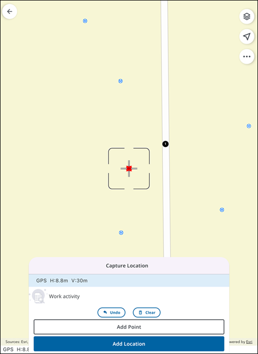
- Tap Map.
The Capture Location panel opens to your current location on the map.
- Add a point by tapping on the map.
- Tap Add Location.
The Location is added and you are brought back to the Location page, where related metadata fields are automatically saved and populated. For lines and polygons, a file with all the GNSS metadata called _gnss_metadata.json is attached to the feature.
The Capture Location panel allows you to add points, lines, or polygons depending on your feature type. It also provides tools to guide your capture process.
- With the Capture Location panel open, tap and drag on the map.
A reticle guide appears on the map and serves as a visual indicator for where the point will be placed.
 NOTE: For features consisting of a single vertex (e.g. a tree or a valve), you must tap directly on the map screen to add a point. The Add Point tool is only available when adding multiple points for linear or polygonal features.
The following options are available on the Capture Location panel:
- Add Point: Tap to add a point when collecting linear or polygonal features. This option is not available for single-point features.
- Add Location: Tap to add a location and return to the Location page.
- Undo: Tap to undo your last action.
- Clear: Tap to clear all points.