Map
The map allows users to view and interact with GIS data in real-time in reference to their current location in the field.
To maximize spatial awareness, you can view all activity types simultaneously on a single map. This comprehensive view provides essential context, allowing you to identify other relevant or nearby work in your area without switching between different activity views.
|
|
 PREREQUISITES:
 IMPORTANT: IMPORTANT: The following are not supported in Trimble Unity Field:
|
 Map Capabilities and Features
Map Display
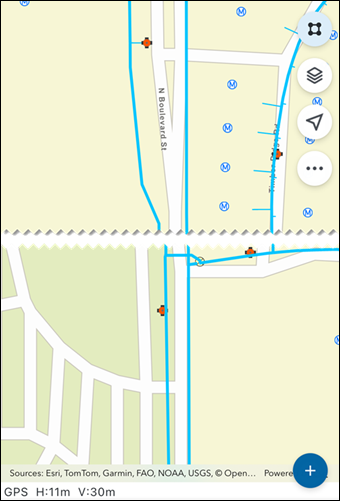
When opened, the map zooms to display all work activities. By default, the map displays all activity types to ensure field crews have full visibility of the total workload in their immediate vicinity. The map appearance is based on basemaps configured to appear in the app. See Switch Base Maps for more information.
Work Activities and Feature Layers
Work activities appear as icons on the map, along with sync-enabled feature layers. Users can toggle between viewing a single activity type or All Activities to better understand the relationship between different tasks and GIS assets. Feature Service Layers are fully supported, whether they are grouped or ungrouped, when included in a web map. See Add a Feature Layer in the Admin Guide for Trimble Unity Maintain and Trimble Unity Permit for more information.
Floor-aware Web Maps
The app automatically detects web maps configured as floor-aware. When a floor-aware map is opened, you can use specialized tools to manage GIS data and work activities within multi-level environments.
- Select Floor: A specialized floor picker widget automatically loads to allow for navigation between sites, buildings, and levels. Selecting a floor in the picker automatically centers and navigates the map to that location.
- Automatic Filtering: Selecting a level in the floor picker filters the map to display only the GIS assets, event layers, and work activities associated with that specific Facility Id or Level Id.
See Select Floor Tool for more information.
Actions
From the map, you can perform the following key actions, including:
- Select assets and work activities
- Toggle layer visibility and selection
- View your current location
- Switch web maps
- Manage offline map areas
- View legend details
- Search for assets or addresses with or without a barcode scanner
- Use the floor picker to automatically center the map and display GIS assets and work activities associated with a specific level
Map Icons
Map icons dynamically update as actions are taken on associated assets and related activities, providing a clear visual representation of progress and remaining tasks. This streamlines workflows by allowing users to quickly identify and take action on related activities and assets directly from the map. The following icons appear on the map:
- Select icon (
 ): Tap to use the selection tool to select assets, GIS features, and work activities on the map.
 - Layers icon (
 ): Tap to enable or disable the selection and visibility of layers.
 - Current Location icon (
 ): Tap to view your current location on the map and switch between different pan modes.
 - Compass icon (
 ): Displays your directional orientation.
 - More Actions icon (
 ): Tap to access the More Actions map menu. See More Actions Menu for more information.
 - Web Maps: Tap to view and switch between any web maps assigned to your user role.
- Offline Map Areas: Tap to view, download, switch, refresh, and clear offline map areas.
- Base Maps: Tap to view and switch between base maps using the Base Maps Selection Tool.
- Legend: Tap to view the map legend.
- Cancel: Tap to exit the menu.
- Select Floor tool (
 ): Tap to view and select floors. This tool is only available on floor aware web maps.
 - Add icon (
 ): Tap to add a new asset or work activity.
Work Activity Icons
Work activity icons appear on the map as follows:
- SR (Service Requests)
- INSP (Inspections)
- WO (Work Orders)
- CASE (Cases)
- TASK (Case Tasks)
- VIO (Case Violations)

 NOTE: TASK (Case Task) and VIO (Case Violation) icons will appear stacked on top of the associated CASE icon when both layers are enabled.

